The nexus between transportation and land use.

Category: Cities Page 1 of 3

Planning for People: A Step Back in History

I would like to follow-up on my Planning for People in Jefferson Park post and expand a bit on what it means to “plan for people”.

For at least the past 60 years, the architecture, planning and engineering professions have fundamentally changed the way they designed cities. Cities, a creation of the human race for over 8,000 years have grown organically – they tended to pop up in places of favorable geography, say a deep harbor, up river at a narrow crossing point, at the nexus of trade routes. Cities expanded organically, one or a few buildings at a time. Streets were footpaths and market lanes. As we’ve moved through the millenia, cities have spread based on transportation technology. Whereas, before 1850 and the advent of the omnibus streetcar, cities were of a walkable size, the technology of the streetcar powered by horse, later by electricity and then the automobile has enabled cities to expand far beyond their initial settlements.

ancient cities photo

The way cities were designed before cars. Florence, Italy. Source: Imulej @Pixabay.


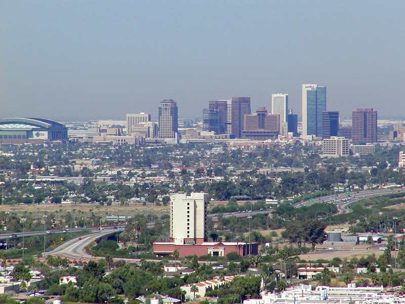
Chandler, Arizona. Source: By Chris J [CC BY-SA 2.0 (http://creativecommons.org/licenses/by-sa/2.0)], via Wikimedia Commons


Why the brief history lesson?

My point is to emphasize that cities were built for people up to and until the time that the automobile became a mass-produced commodity that the middle class could afford. In America, this was shortly after World War II. Something radical happened around that time. To make up for severe housing shortages caused by decades of depression followed by war, we found a way to mass produce housing and to tailor it towards the convenience of the car. These design decisions became codified into our zoning codes, our engineering standards and our architecture practices to produce an endless arrangement of Chandler, Arizonas.

An Ending and a New Beginning

We have reached a point where that phase of city building is over. As Chuck Marohn at Strong Towns and others have documented (myself here), the Suburban Growth Ponzi Scheme has come to an end. And it has come to an end here in Jefferson Park as the first cycle of the suburban development pattern, consisting of structures built-in the 1940s – 1960s has largely passed its useful life. You see this crumbling along Milwaukee Avenue in Gladstone Park in particular. The five lane stroad serving only 20,000 cars per day, empty businesses and listless place. It is an area lacking in pedestrian and transit-oriented design, in placemaking.

A new beginning for planning for people in Jefferson Park means returning to the tools of city planning for designing places for people. It means taking advantage of the design features that will bring people to places. These design features include things like medium to high residential densities, mix of land uses, safe street crossings, 2-4 travel lanes, transit, street-oriented buildings and comfortable outdoor spaces. In the next series of posts, I intend to highlight how Jefferson Park can plan for people utilizing these design strategies.

A reboot is needed. One in which we get back to the ancient art of building places…for people.


Why mass transit is doomed

Metra over traffic

Mass Transit in Chicago. Source: Steven Vance @flickr

I can’t recommend reading Alex Pareene’s article enough on why mass transit is doomed. Sure, it’s true that politicians don’t use it. Let’s put this into a Chicago context. How often do you think Rahm Emanuel rides the CTA, despite living a couple of blocks from the Montrose Brown Line? What about Pat Quinn, who could commute from his northwest side neighborhood in Galewood on the Metra? Before you answer – consider this fact. There exists, under the James Thompson Center (aka Illinois Capitol Building north), a non-public parking garage restricted to select public employees. A similar parking situation exists in the Daley Center, next to City Hall. When parking is free in places it shouldn’t be, what are the incentives for politicians to drive?

Another example. Several years ago, when I was an intern with the Chicago Transit Authority, the Board of the CTA took a tour of the Block 37 cavern. (Let’s neglect the fact that this behemoth was sprung from the brainchild of another politician known for never riding the CTA, Richard Daley. And let’s neglect for the moment that a $200 million basement makes a difference to precisely no one. Imagine a $200 million investment in trains and buses). How did they get there? Not by the Green Line Clinton Station, right outside CTA headquarters. No, there was vehicle transportation arranged for them. Keep in mind that this is the Board of the Chicago Transit Authority.

This is despite the fact that 27% of workers within the City of Chicago take public transportation to work. One in four.

And now, when the CTA is proposing a bus rapid transit solution along Ashland Avenue that speeds up travel times on one of the busiest bus routes in its system, it runs into vehement opposition because it makes driving a car slightly more cumbersome. Because, you know, driving is a god given right also enshrined in our constitution. And everyone drives (except for those 27%).

The problem is, Chicago’s mass transit system, combined, is the third largest in the country. It faces a significant capital shortfall of $18 billion to address state of good repair needs and needs an additional $12 billion over 10 years for normal capital reinvestment. Yet, the system’s sources of funding are not stable and subject to economic swings (sales tax receipts, real estate transfer tax, etc.).

You know when the State gets its way on a ridiculously flawed highway proposal that it cannot afford, and it steamrolled the transit agencies to vote in support of it, against their interests, that mass transit is doomed.

How the government shutdown affects transportation planning

Source: Beforeitsnews.com

As you have no doubt heard by now, the federal government has shutdown. So for those in the transportation planning community what does this mean?

  • In Chicago, my own agency will be running normal schedules with no direct impacts to riders due to the shutdown. However, we might have a few less riders because…
  • Chicago is fourth on the list for non-Post Office federal employee population with 16,069 employees, many of whom work downtown. This includes offices of the Federal Transit Administration, General Services Administration and Environmental Protection Agency, three departments that will see massive furloughs. Outside of D.C., New York, Atlanta and Philadelphia are tops on that list by the way.
  • If you have projects funded by the U.S. Department of Transportation, you may want to consider hitting the pause button. “No grants, cooperative agreements, contracts, purchase orders, travel authorizations, or other documents obligating funds will be executed to any of the FTA’s 1300 grantees” according to DOT guidance. For transit agencies, grant money, obligating funds, etc. that you are getting daily from the FTA will cease. Almost all FTA staff will be furloughed. In October of FY2013, FTA payments to grantees averaged about $200m per week.
  • The above being said, if you are in the construction management or a contractor and your project stalls, don’t expect to get paid until the shutdown ends. Many transportation agencies may be loath to dip into their reserve funds to keep projects going unless there are signs that the shutdown will be short-lived.
  • Air Traffic Controllers will be on the job, although some non-“essential” FAA employees will be on furlough. TSA agents will also be on the job. If your airport is undergoing an airport planning process or is currently receiving planning grants, your project may be stalled.
  • The Federal Railroad Administration will furlough half of its employees, none of them involved in safety operations. Functions to be suspended include the high-speed rail initiative, all grant and financial assistance activities, and Railroad Rehabilitation and Improvement Financing (RRIF) loan payments.


Wealth, Generation Y and Cities

Abandoned Paradise

Abandoned Paradise (Photo credit: Seamoor)

Reading this article in the New York Times (and this one) about the lag in wealth building by younger generations compared to their parents has had me reflectively thinking about my own situation. I have two degrees, including a masters. My wife and I even managed to save for a house, which we purchased in 2009 (in hindsight, it appears we bought too early as we’re likely underwater). We also have two kids. Needless to say, our finances are strained. The way things are looking, I’ll pay off all my student loans shortly before I am 60. That would be after both of my daughters complete college, in which case I’ll likely be paying loans off until death. And that’s OK. It’s a decision I made. And yet, I can’t help but feel something is deeply problematic with the financial situation facing much of my generation. The job market sucks, making it  difficult to build a life on a foundation of debt. And if you are fortunate to have a job like I am, then perhaps you are faced with stagnate or declining wages over the long term. But costs are going up. Housing, education, health care, transportation and energy costs have all risen dramatically while income has fallen.


I can’t say how this will play out over the long term. But these trends have an effect on the way people live and our cities are evolving to meet the demands that these trends are making. From a planning perspective we are likely to see the following trends continue, for better or worse.


  • Decline in the traditional household patterns. Forget the 1950’s married couple with 2.5 kids. That’s been gone for a long time and unlikely to return. My generation is getting married later (if at all) and not having children at nearly the same rate as our parents.
  • Continued influx of Generation Y to the cities. This, from an urbanist perspective, is overwhelmingly good. Gen Y doesn’t have the love of cars as previous generations (hell, we can’t afford them) and are looking at cities with new found opportunities. We’re reinvesting in places with existing infrastructure, thus reducing the need for greenfield development. What remains to be seen is whether my generation stays in the cities and that will largely be determined by whether we can make the city livable for all classes of people. Thus, how do we improve municipal finance, urban schools, gentrification/displacement of the poor, and clean up and adaptively reuse brownfield redevelopment.
  • Houses as we know them will be radically different. Gone are the days of large scale cookie-cutter subdivisions as the predominant residential building mode. To meet the needs of Gen Y (and the downsizing baby boomers) we’ll need a lot more multi-family and smaller, more efficient homes near transit. I also suspect the cookie-cutter houses that will go up for sale as the boomers downsize will not find enough buyers, as Gen Y is a smaller generation and seems, at this point, wholly uninterested in moving to the suburbs to the extent our parents did.
  • Public transit will face an existential crisis but will survive. The current financing model for public transit is outdated and does not reflect the economic or demographic realities of our time. Federal support will decline and transportation will increasingly be solved by local governments. However, the demand by Gen Y and the baby boomers (who will, inevitably, learn to ride transit not by choice, but out of necessity due to aging) for public transit will become overwhelming, in reality and politically. Now, what public transit looks like is another story. I can see room for private operators (e.g. jitneys, taxis, even ferries) as public providers contract services, particularly in outlying areas. I think we’ll see a refocus on urban areas where traditional transit has the greatest chance of success.

Our cities will experience a bit of a renaissance as people move back in. On the other hand, the suburban experiment is likely due for hardship. While appealing to some, I can’t see how it sustains itself in its enormity from a market standpoint and fiscal reality. There frankly isn’t a market for the sheer number of single family homes in cul-de-sacs out there. And governments cannot afford the replacement costs of the second generation of infrastructure that many of these suburbs will be requiring over the next 20 or so years. This may lead to a situation similar to many European cities (e.g. Paris) where the center city is luxurious and the suburbs surrounding it are falling apart.


If this is truly our future, I pray that I have made the prudent lifestyle decisions to support my family. We’ll see.


Phoenix

Phoenix. The Valley of the Sun. Soon to be home to my sister and her girlfriend. They’re moving at the end of the month to start the next phase of their lives together. I am sad, of course, and yet happy for them on this exciting adventure. I am no expert in Phoenix, having only visited the city once, but as an urban planner, I am adept at researching city data. So, here I present some interesting facts and observations about Phoenix from a planning perspective.

It’s Big!

Phoenix’s population is 1.469 million people. The city alone accounts for 22% of the State of Arizona’s population, making it the primate city in the state. It’s the 6th most populous city, behind New York, Los Angeles, Chicago, Houston and Philadelphia. It’s metropolitan area is home to two-thirds of all Arizonans. It’s footprint is gigantic as well. Lying in the Salt River Valley of the Sonoran Desert, Phoenix spreads out over 516 miles, more than twice the land area of Chicago. And for all that land, it’s not particularly dense, with only 2,800 people per square mile, or about a quarter of Chicago’s population per square mile. This kind of density is hard to support transit, but you might be surprised that one of the newest and most successful light rail lines was built in the city recently (more on that below).

Getting Around

Given the size of the urban area and the character of its urbanism (suburbanism), a car is essential for reasonable travel. Unfortunately, your visitors will be arriving via plane, as the last passenger rail service was suspended in 1996. Phoenix is the largest city without intercity passenger train service. However, visitors landing at Sky Harbor International Airport have the option of taking the train. The Metro light rail system, a 20 mile single line system serving 28 stations, opened in 2008. The line serves central Phoenix, Tempe and Mesa. Back to being big – Mesa, at almost 440,000 people, is the second largest suburb in the U.S., ranking above many major cities like Miami, Atlanta, and St. Louis.

Sky Harbor is the main Phoenix airport and has a Southwest hub, very important for travel back to Chicago. It’s the 10th busiest in terms of passenger traffic.

Roads are plentiful. The main interstates are 10 and 17. I-17 will take you to Sedona in 2 hours, Flagstaff in 2 and a half. I-10 will take you to L.A. in 7 hours or so. As a Chicagoan, I was struck by the size of the arterial roads in the Phoenix area. Six lanes with a double left turn lane are common. It’s no wonder everyone drives.

Similarities to Chicago

Not many as you might expect. But the obvious ones are sports related. The Chicago Cubs have the spring training home in Mesa, attracting a lot of Chicagoans to visit and retire. Also, not to be forgotten, is the fact that the Arizona Cardinals used to be the Chicago Cardinals until 1960. I also think Phoenix’s dominance as Arizona’s primate city and capital is somewhat similar to Chicago. And the prevalance of the cardinal direction street grid is familiar to Chicagoans.


Like all cities, Phoenix is fascinating and has an interesting story. From my perspective as an urban planner, particularly in the transportation realm, I am fascinated by the urban form of the region, how transportation or natural (or political) boundaries enforce the geography of a place. Phoenix has more stories to tell.

Cross posted at Ryan J. Richter.

Page 1 of 3

Powered by WordPress & Theme by Anders Norén